Over a foot of rain falls in South as severe weather heads toward East Coast
Over a foot of rain has fallen in Wiggins, Mississippi, since Tuesday.
A storm system plaguing parts of the southern U.S. for almost a week brought nearly 13 inches of rain to southern Mississippi on Saturday, causing widespread flash flooding and prompting a flash flood emergency on Saturday evening.
Six states have seen locations with over 6 inches of rain in the last week: Texas, Louisiana, Arkansas, Oklahoma, Kansas and Mississippi.
There were also at least 47 reports of severe weather from Louisiana to Virginia, including two reported tornadoes in the latter.
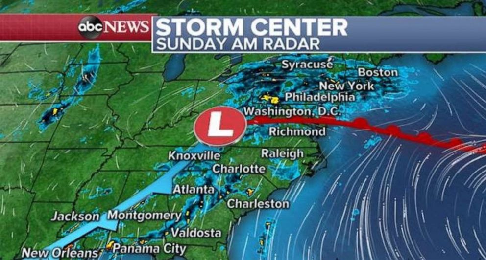
Thunderstorms are firing up along the tail end of the storm system on Sunday morning. That means there is the possibility for an additional 3 to 5 inches of rainfall during the morning in parts of Louisiana, Mississippi, Alabama and extreme western Florida.
There are still flash flood watches issued for parts of the Gulf, and new flash flood watches are being issued now for parts of the Mid-Atlantic as well, as this slow-moving storm system finally reaches the East Coast. As the storm moves east, it will interact with another developing storm system -- although faster and weaker.
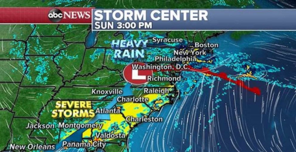
Later Sunday, severe storms will likely fire up from Alabama to Virginia, including parts of the Atlanta, Charlotte and Raleigh, North Carolina, metro areas. Damaging winds and some hail are the main risk. Brief tornadoes are possible, though unlikely given the atmospheric conditions. However, any slow-moving thunderstorm could produce flash flooding.
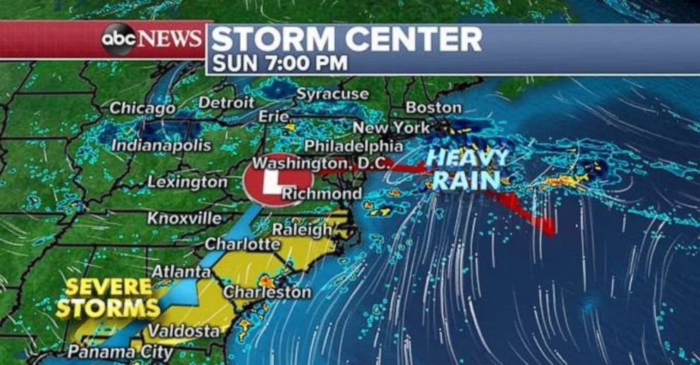
Severe storm activity will reach the East Coast by Sunday night, with some gusty thunderstorms possible in parts of Charleston, South Carolina, and Raleigh. Meanwhile, unsettled weather will begin moving through parts of the Midwest with rain from Chicago to Erie, Pennsylvania.
By Monday morning, this new storm system will begin to interact with the slow-moving storm departing the East Coast and expand the rainfall across parts of the Northeast and New England.
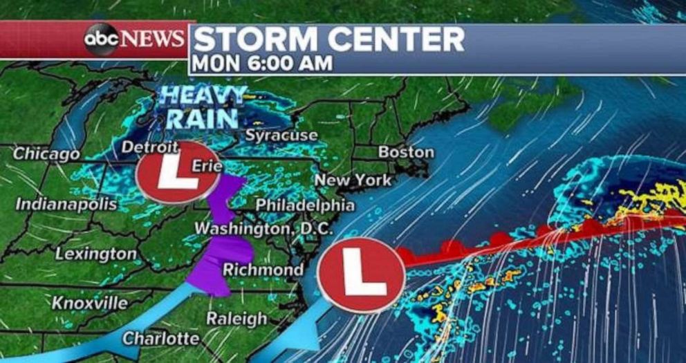
Pockets of heavy rain, with some areas of gusty winds, will develop on Monday across the Northeast. Locally heavy rainfall will cause flash flooding in parts of the region through Monday night.
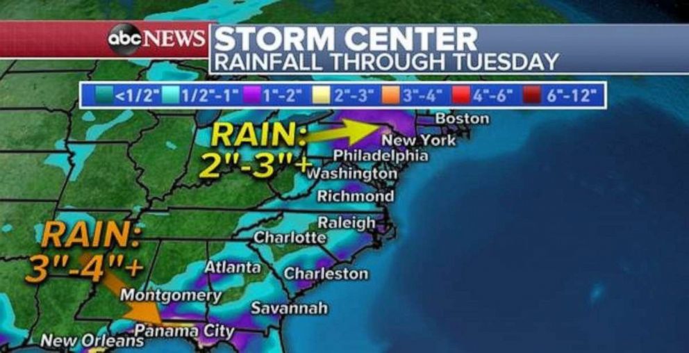
A large area of the East Coast seeing 1 to 3 inches of rain through Tuesday, with a couple of pockets of heavier rainfall. The main concern is for more rainfall on the Gulf Coast, where 3 to 4 inches of additional rain is possible, and areas of the interior Northeast, where 2 to 3 inches of rain could fall in the hillier terrain of the Appalachians.
Related Topics
