Santa Ana winds create fire danger in California, new major storm to hit Northeast
A red flag warning has been issued for the entire coast of Southern California.
A major Santa Ana wind event is ongoing right now in Southern California from outside of Los Angeles down to just outside of San Diego.
The National Weather Service has posted a rare extreme fire danger warning for Ventura, Los Angeles and the San Diego county mountains.
Here is where the extreme fire danger is on the map:
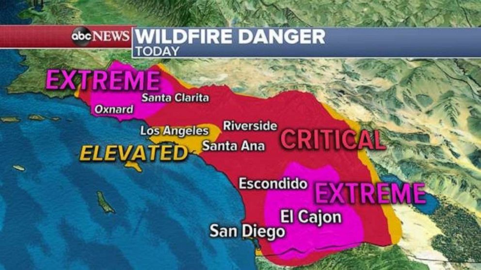
The National Weather Service issued a stark warning, saying, “this is a particularly dangerous situation due to an unusual duration of extremely dry vegetation, strong winds, and very dry air leading to very critical fire weather conditions.”
There are also two wildfires burning east of San Diego.
The Bond Fire is located in Silverado Canyon and has exploded to 7,200 acres on Thursday. The blaze was sparked by a house fire and mandatory evacuations are now in place.
Two U.S. Forest Service firefighters were injured in the Bond Fire, Orange County Fire Authority Chief Brian Fennessy confirmed to ABC News.
More than 123,000 customers, mostly in Riverside and San Diego counties, are without power due to power safety shutoffs.
The Airport Fire, which has burned through more than 100 acres, has closed portions of the 71 freeway near Corona Airport.
Meanwhile, a red flag warning has been issued for the entire coast of southern California including Los Angeles.
Winds could be gusting 50 to 60 mph and, locally, it could even get higher than 70 mph meaning these conditions will be prime for extreme fire behavior and fire spread.
The worst of the winds will be Thursday from the morning into early afternoon.
Snow, wind in the Northeast
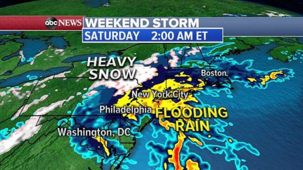
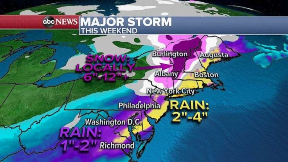
Elsewhere, a major storm system is developing in the South and it is expected to swing north and east bringing flooding rain to the I-95 corridor and more than a foot of snow for inland Northeast.
This storm system has already brought more than a foot of snow to Oklahoma, Kansas and New Mexico where numerous accidents have been reported.
This storm will strengthen as it moves Northeast into the Interstate 95 corridor Friday evening spreading the heavy rain into the area Friday night into Saturday morning with gusty winds also expected 30 to 50 mph.
Further inland, from upstate New York to Vermont and New Hampshire, some areas could see more than a foot of snow.
Related Topics
